By Molly Jackman, Public Policy Research Manager
After a flood, fire, earthquake or other natural disaster, response organizations need accurate information, and every minute counts in saving lives. Traditional communication channels are often offline and it can take significant time and resources to understand where help is desperately needed.
Facebook can help response organizations paint a more complete picture of where affected people are located so they can determine where resources — like food, water and medical supplies — are needed and where people are out of harm’s way.
Today, we are introducing disaster maps that use aggregated, de-identified Facebook data to help organizations address the critical gap in information they often face when responding to natural disasters. Many of these organizations worked with us to identify what data would be most helpful and how it could be put to action in the moments following a disaster.
This initiative is the product of close work with UNICEF, the International Federation of the Red Cross and Red Crescent Societies, the World Food Programme, and other organizations. It is an example of how technology can help keep people safe, one of our five areas of focus as we help build a global community.
Based on these organizations’ feedback we are providing multiple types of maps during disaster response efforts, which will include aggregated location information people have chosen to share with Facebook.
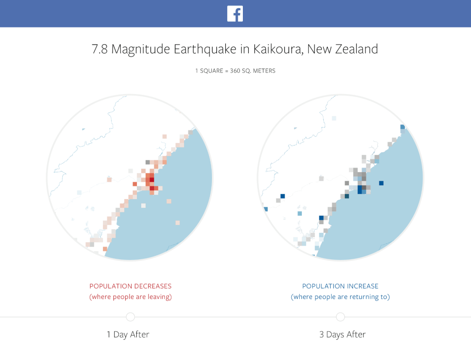
Location density maps show where people are located before, during and after a disaster. We can compare this information to historical records, like population estimates based on satellite images. Comparing these data sets can help response organizations understand areas impacted by a natural disaster.
Movement maps illustrate patterns of movement between different neighborhoods or cities over a period of several hours. By understanding these patterns, response organizations can better predict where resources will be needed, gain insight into patterns of evacuation, or predict where traffic will be most congested.
Safety Check maps are based on where our community uses Safety Check to notify their friends and family that they are safe during a disaster. We are using this de-identified data in aggregate to show where more or fewer people check in safe, which may help organizations understand where people are most vulnerable and where help is needed.
We are sharing this information with trusted organizations that have capacity to act on the data and respect our privacy standards, starting with UNICEF, the International Federation of the Red Cross and Red Crescent Societies, and the World Food Programme. We are working with these organizations to establish formal processes for responsibly sharing the datasets with others.
Over time, we intend to make it possible for additional organizations and governments to participate in this program. All applications will be reviewed carefully by people at Facebook, including those with local expertise.
We believe that our platform is a valuable source of information that can help response organizations serve people more efficiently and effectively. Ultimately, we hope this data helps communities have the information they need to recover and rebuild if disaster strikes.